


SPRING Voting District, Boone County, Illinois
About
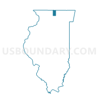
Outline

Summary
| Unique Area Identifier | 564591 |
| Name | SPRING Voting District |
| County | Boone County |
| State | Illinois |
| Area (square miles) | 36.15 |
| Land Area (square miles) | 36.10 |
| Water Area (square miles) | 0.05 |
| % of Land Area | 99.85 |
| % of Water Area | 0.15 |
| Latitude of the Internal Point | 42.19711710 |
| Longtitude of the Internal Point | -88.75751980 |
Maps


Graphs
Select a template below for downloading or customizing gragh for SPRING Voting District, Boone County, Illinois


Neighbors
Neighoring Voting District (by Name) Neighboring Voting District on the Map
- BELVIDERE 15 Voting District, Boone County, IL
- BONUS 1 Voting District, Boone County, IL
- BONUS 3 Voting District, Boone County, IL
- FLORA 1 Voting District, Boone County, IL
- FLORA 2 Voting District, Boone County, IL
- FRANKLIN 2 Voting District, DeKalb County, IL
- GENOA 1 Voting District, DeKalb County, IL
- KINGSTON 1 Voting District, DeKalb County, IL
- Marengo 1 Voting District, McHenry County, IL
- Riley 1 Voting District, McHenry County, IL
Top 10 Neighboring County Subdivision (by Population) Neighboring County Subdivision on the Map
- Belvidere township, Boone County, IL (30,109)
- Marengo township, McHenry County, IL (7,564)
- Genoa township, DeKalb County, IL (5,704)
- Bonus township, Boone County, IL (4,340)
- Kingston township, DeKalb County, IL (3,519)
- Flora township, Boone County, IL (2,981)
- Riley township, McHenry County, IL (2,922)
- Franklin township, DeKalb County, IL (2,502)
- Spring township, Boone County, IL (894)
Top 10 Neighboring Place (by Population) Neighboring Place on the Map
Top 10 Neighboring Elementary School District (by Population) Neighboring Elementary School District on the Map
- Marengo-Union Elementary Consolidated District 165, IL (10,535)
- Riley Community Consolidated School District 18, IL (3,398)
Top 10 Neighboring Secondary School District (by Population) Neighboring Secondary School District on the Map
Top 10 Neighboring Unified School District (by Population) Neighboring Unified School District on the Map
- Belvidere Consolidated Unit School District 100, IL (45,236)
- Genoa-Kingston Community Unit School District 424, IL (9,221)
- Hiawatha Community Unit School District 426, IL (3,324)
Top 10 Neighboring State Legislative District Lower Chamber (by Population) Neighboring State Legislative District Lower Chamber on the Map
Top 10 Neighboring State Legislative District Upper Chamber (by Population) Neighboring State Legislative District Upper Chamber on the Map
Top 10 Neighboring 111th Congressional District (by Population) Neighboring 111th Congressional District on the Map
Top 10 Neighboring Census Tract (by Population) Neighboring Census Tract on the Map
- Census Tract 104, Boone County, IL (6,841)
- Census Tract 102, Boone County, IL (6,105)
- Census Tract 8710.04, McHenry County, IL (6,030)
- Census Tract 2, DeKalb County, IL (5,013)